
Precision Aerial Data Acquisition and Visual Content for Perris
California's Elevated Perspective
For any aerial data acquisition requirement across California, including advanced applications such as magnetometer and electromagnetic surveys, LiDAR, and precise GIS mapping, Perris Helicopter Charters delivers comprehensive solutions. We capitalize on the inherent low-altitude flight and stable hover capabilities of helicopters to facilitate high-resolution data capture. Furthermore, our specialized aerial filming services integrate state-of-the-art cinematography and photography platforms, offering robust technical options ranging from stabilized camera systems to specialized door-off configurations for dynamic handheld operation. Whether documenting infrastructure in the Inland Empire or geological formations throughout California, our extensive range of aerial services provides unmatched versatility and precision from an elevated perspective.
Aerial
Surveys
LiDAR, GIS Maps, FLIR, HD Video & More
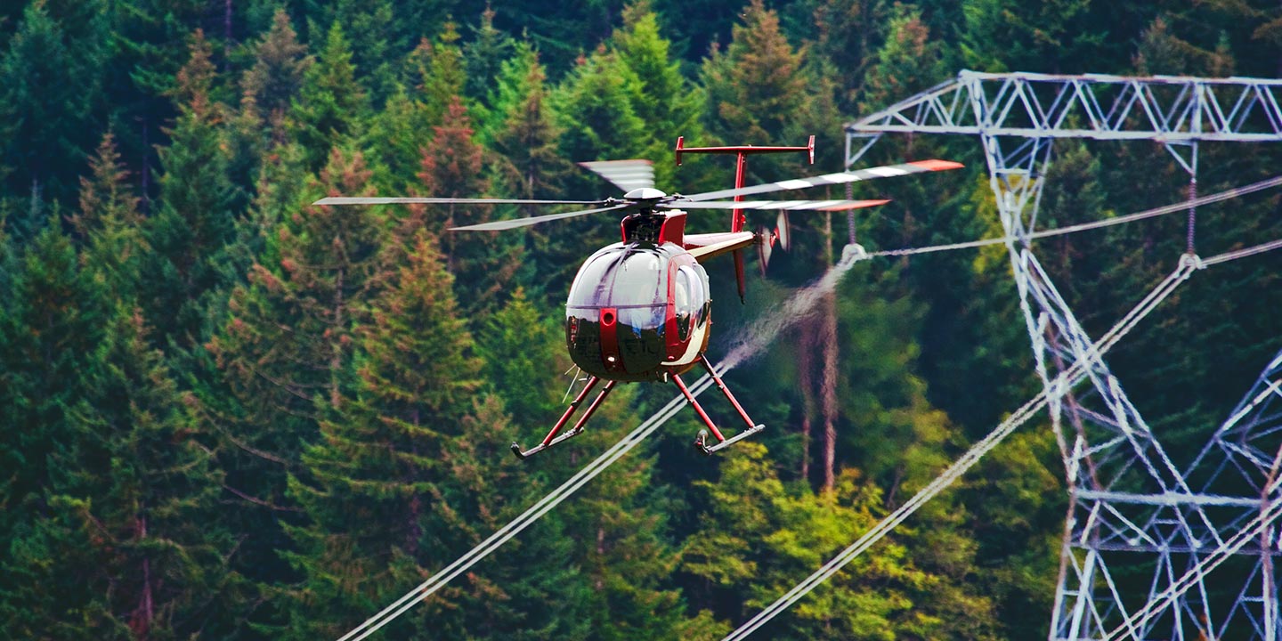
Perris Helicopter Charters provides integrated aerial solutions for critical infrastructure assessments. From precise pipeline integrity surveys and right-of-way (ROW) inspections to extensive transmission line patrols across California, we ensure project success. We facilitate access to advanced rotorcraft specifically outfitted with requisite sensor packages and managed by highly experienced flight crews, delivering unparalleled operational precision.
High Tech Results
The Top Pilots in California, Today's Technology... Maximum Results.
Call 1-866-826-4826 Now!
Perris Helicopter Charters provides the tools needed to complete your land surveys, utilizing the right equipment to provide the aerial photos that are often needed.
A precisely executed aerial survey simplifies complex operations such as right-of-way (ROW) and site inspections, high-resolution topographical data acquisition, and detailed photographic documentation for commercial projects throughout Southern California. Helicopter-based surveys are unequivocally the most effective method for comprehensive terrain analysis, diligent pipeline integrity checks for potential anomalies, proactive detection of transmission line infrastructure issues, and high-fidelity visual asset capture. Perris Helicopter Charters specializes in developing bespoke photographic and remote sensing strategies, meticulously tailored to optimize technical efficacy, enhance financial efficiency, and consistently achieve superior project outcomes for clients across Perris and beyond.
Helicopters possess distinct aerodynamic advantages over fixed-wing aircraft, enabling significantly lower and slower flight profiles which are paramount for precision aerial surveying. While Federal Aviation Administration (FAA) regulations mandate fixed-wing operations maintain a minimum of 1,000 feet above the highest obstacle, helicopters can operate at substantially reduced altitudes, providing a granular perspective critical for detailed inspections. This operational flexibility also permits direct access and close-range assessment of challenging or hazardous environments, offering engineers and field personnel an invaluable, otherwise unattainable, vantage point for data collection and analysis across the varied terrain of the Perris Valley and beyond.
There is no better way to conduct your visual survey, animal population counts, soil drainage analysis, ROW inspections, pipeline and transmission line inspections, and geographical surveys.
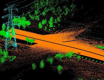
LiDAR Imaging
Light Detection and Ranging, or LiDAR, is a remote sensing method used to examine and measure California topography as well as objects, like vegetation, upon it.
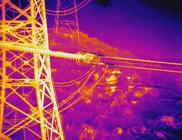
Infrared Imaging
Thermographic IR cameras are used to detect radiation in the long-infrared range of the electromagnetic spectrum and produce images of that radiation, called thermograms.
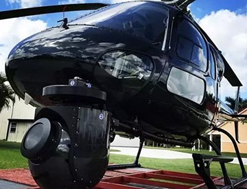
HD Video Gimbal Capture
Modern HD and 4K cameras can be mounted to helicopters, using the proper STCs, with a gimbal to stabilize photos & videos for detailed results.
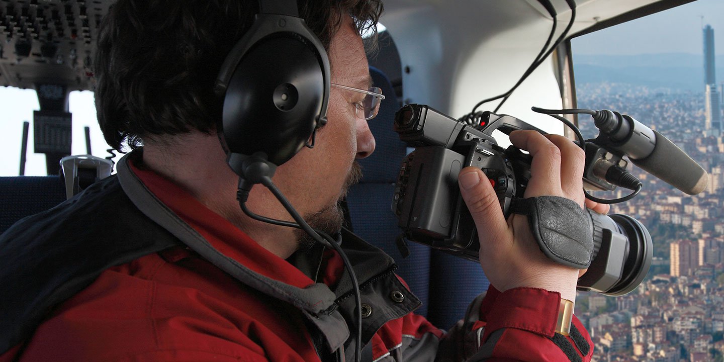
Elevated Cinematic Production and Aerial Visual Solutions
For expert camera work in the Perris Sky
Get a Fast, free QuotePerris Aerial Cinematography
Perris Helicopter Charters facilitates unparalleled access to comprehensive resources for professional-grade aerial cinematography across California. We enable custom production shoots by integrating advanced technological platforms, including industry-leading gyro-stabilized camera mounts such as Tyler Mounts, Wesscam, Cineflex, Pictorvision, and SpaceCam. These systems are compatible with high-performance specialty cameras like the Cineflex HD, RED Epic, Arri Alexa, and even cutting-edge 3D or experimental camera configurations, ensuring your creative vision is technically realized. Whether requiring dynamic air-to-air sequences or precise ground-to-air perspectives, we support every facet of your production objectives. Our operational teams are adept at collaborating intimately with aerial Directors of Photography and production directors, meticulously executing flight profiles to achieve the exact visual narrative desired. Specializing in rotorcraft deployment for both still and motion photography, Perris Helicopter Charters is equipped to support nearly every media-related operation throughout California, from feature films, television series, and documentaries to promotional videos, commercials, and aerial prop staging. This also extends to critical relief work for broadcast networks and providing unparalleled coverage of historical events or major sporting spectacles across the diverse landscapes of the Golden State, from the beaches of Orange County to the mountains surrounding Lake Perris.
Call Us Today at 1-866-826-4826 for a Free Quote
Contact Us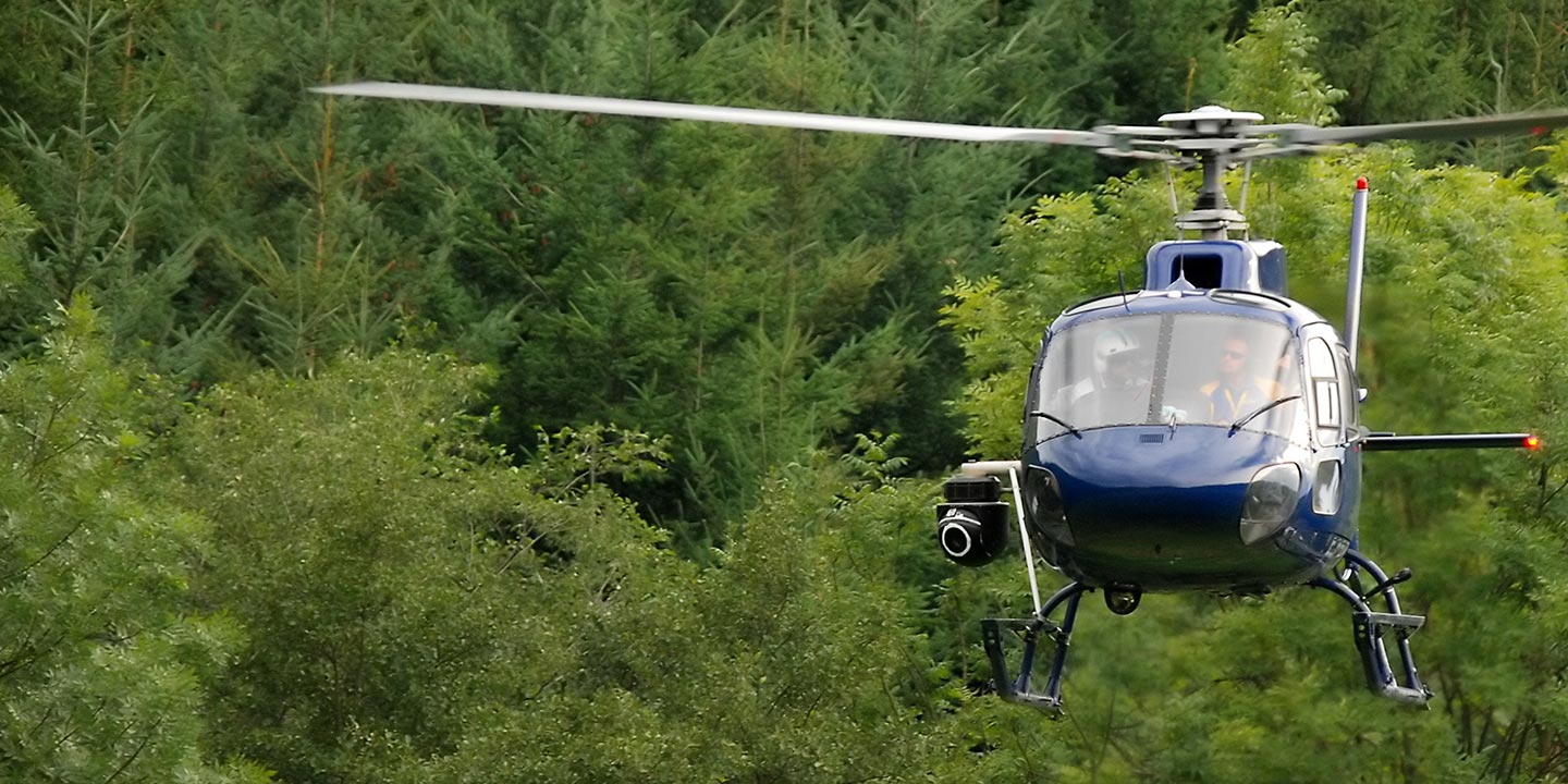
Aerial Photos
Hand-held or Mounted OpTions in Perris
We will help you get the right equipment for your aerial photography project! Call 1-866-826-4826 today to get a fast, free quote.
The Most Options for Photography
California's dramatic landscapes and unparalleled scenic vistas are optimally documented from an aerial perspective. Elevate your visual content creation with a specialized aerial photography charter, meticulously designed to translate your artistic vision into precise, high-impact imagery. Perris Helicopter Charters is poised to provide clients across the Perris region with cost-effective access to premium aerial photographic capabilities. Many rotorcraft can be configured for specialized door-off operations, ideal for dynamic handheld photographic projects. For enhanced stabilization and cinematic precision, we also offer access to advanced gyro-stabilized camera systems, ensuring superior image quality and control for even the most demanding professional requirements.
Superior Service
Every one of our customers gets a dedicated helicopter expert to assist with flight plans, tech loadouts, production logistics, project schedules, and other demands.
Over 500 Aircraft
Our network of direct air partners extends well beyond Perris, California. This allows us to offer a wide range of solutions for even the most sophisticated projects.
The Best Equipment
From high-tech sensors like LiDAR, FLIR, and GIS to HD cameras and movie production gimbals, we're here to make your job as easy as possible.


